
Your Best MG Driving Roads (Updated)
Over the years, NAMGAR members have driven thousands of miles to and from GTs, Regional events, and on personal trips and vacations. Here’s your opportunity now to share your favorite roads – whether they are in the US, Canada, or anywhere else in the world.
To submit your entry to this page, please email the Internet Coordinators with a brief description of the road, the road number, starting and ending points, why the road is special and, if available, please include a relevant photo. Please enter the words “Good MG Road” in the subject line of your email. Entries will appear in alphabetical order of the state or province.
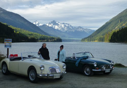
BRITISH COLUMBIA
Highway 99 from Mt Currie to Lillooet thru the Coastal Mountains. Also known as the Duffey Lake Road. This road has 57 miles of twists and turns, ups and downs, through amazing scenery of trees, lakes, and mountains. This road may be closed in winter.
CALIFORNIA
Route 36 from Red Bluff (on the I5) west to Fortuna on the Pacific coast. This is 140 miles of a roller-coaster road with unpredictable sudden turns left and right, and no guard rails! (Watch for motorcycles).
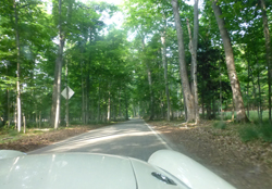
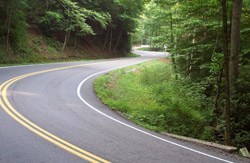
MICHIGAN
We stumbled upon the “Tunnel of Trees” on our drive back from GT39 in Ottawa. This is in Michigan, between Cross Village and Harbor Springs, on M119. It is 22 miles of sharp turns, with the trees very very close, along the shore of Lake Michigan. Fortunately, we did not meet many cars or bikes during our drive as it is just one car wide in many places. It takes about 45 minutes to an hour to drive this, without stops, as there are so many turns and most are very slow. A couple of cafes and a restaurant can provide succour along this road. You can access M119 off of 31 or I75 to the east.
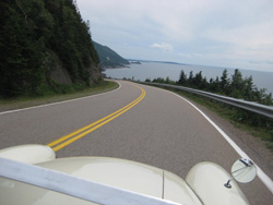
NOVA SCOTIA
One of our favorite trips in the MGA was to Cape Breton in NS. The purpose of the overall 2400 mile trip was to drive the famous Cabot Trail. The trail is 185 miles long and is a complete loop along the upper end of Cape Breton Island. To the best of my knowledge the Cabot Trail has no route number and since it is a loop, here is no actual start and end point
The trail takes you up and down, through hills and valleys, and drops dramatically down to sea level. I took the picture below from the passenger seat while Melon was driving the western side of the loop.
Click here for more info and pictures can be found on the Doris website.
)